


Generator
History


Add a photo
Edit options
 Choose a category
Image Optimization
Image Quality & Correction
Exterior Enhancement
Interior Enhancement
Lighting, Color & Exposure
Sky Replacement
Virtual Twilight
Weather & Seasonal Editing
Holiday Decorations
Fire in Fireplace
Object & Element Specific
 Choose a enhancement
Choose category first
Looking for any specific?

 Count
Count
AI Drone & Aerial Photo Enhancer
Transform flat aerial shots into stunning, high-contrast property showcases. Perfect lot lines, enhance natural colors, and elevate listing curb appeal instantly.
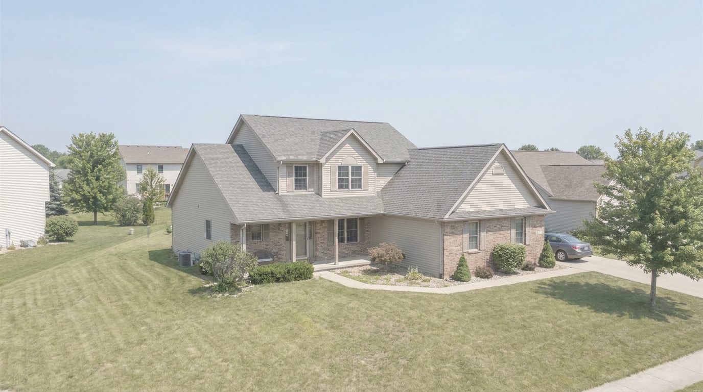
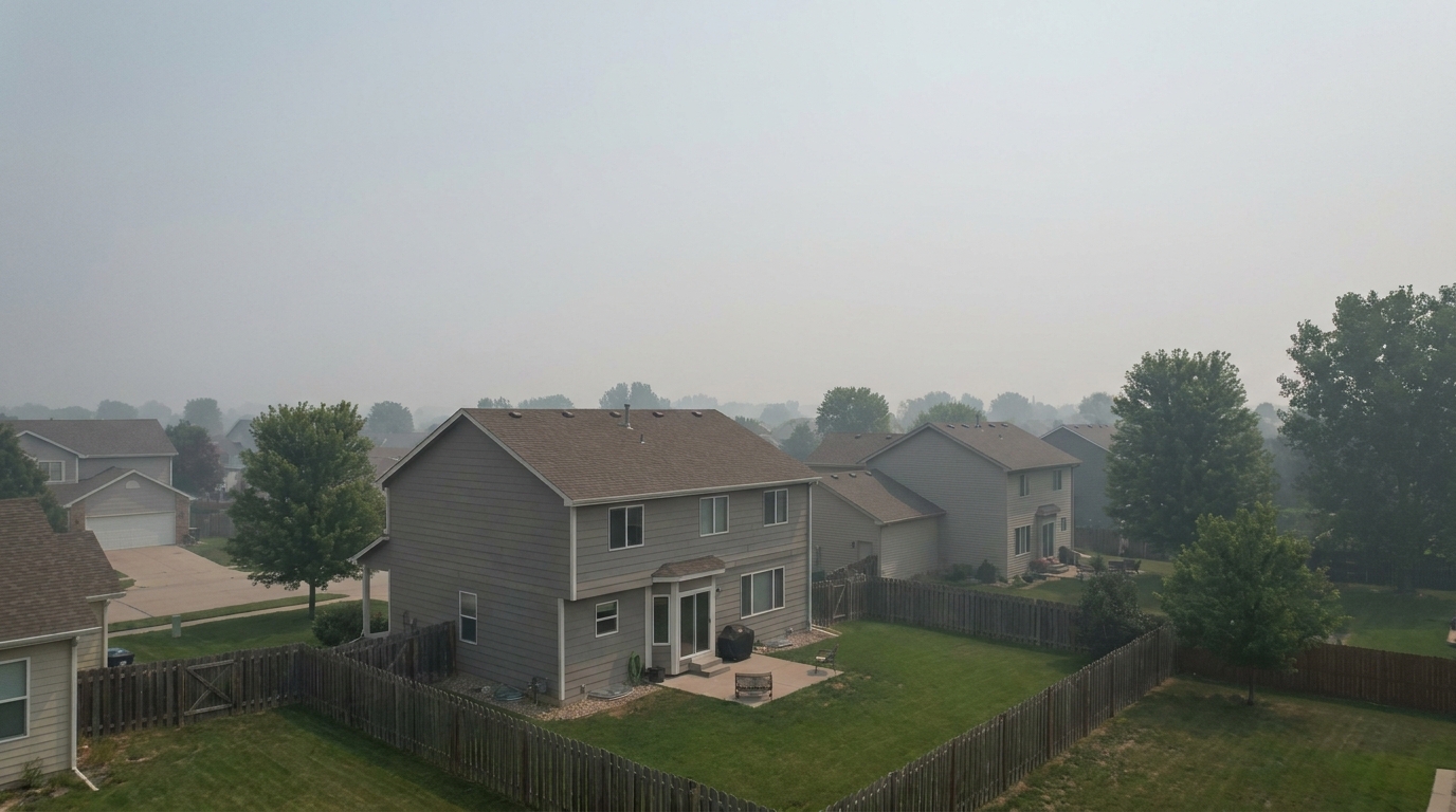
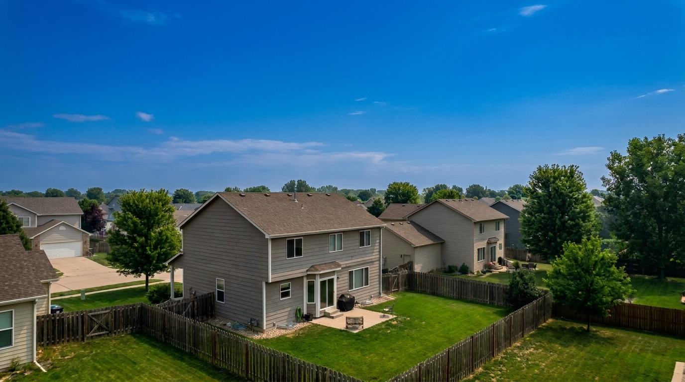
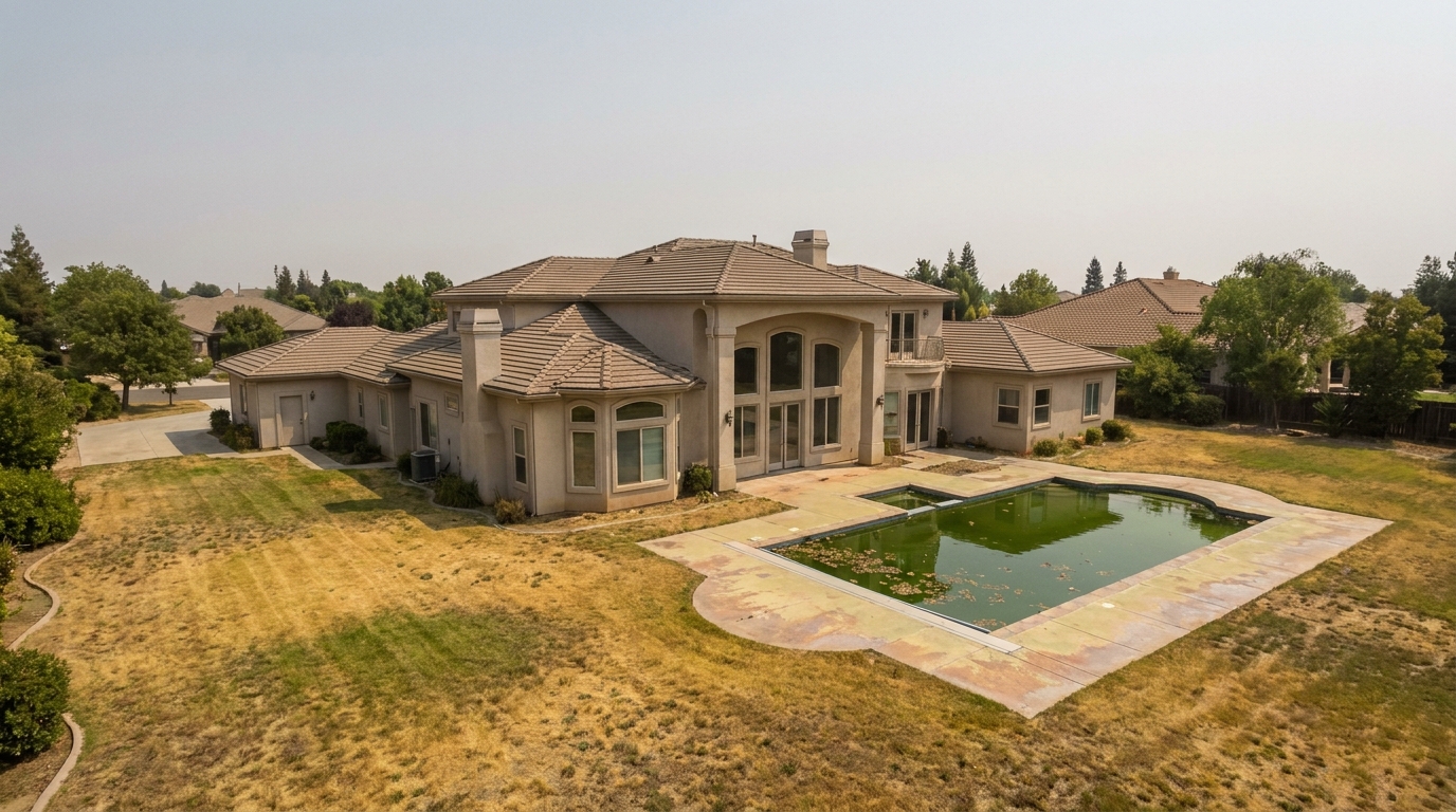
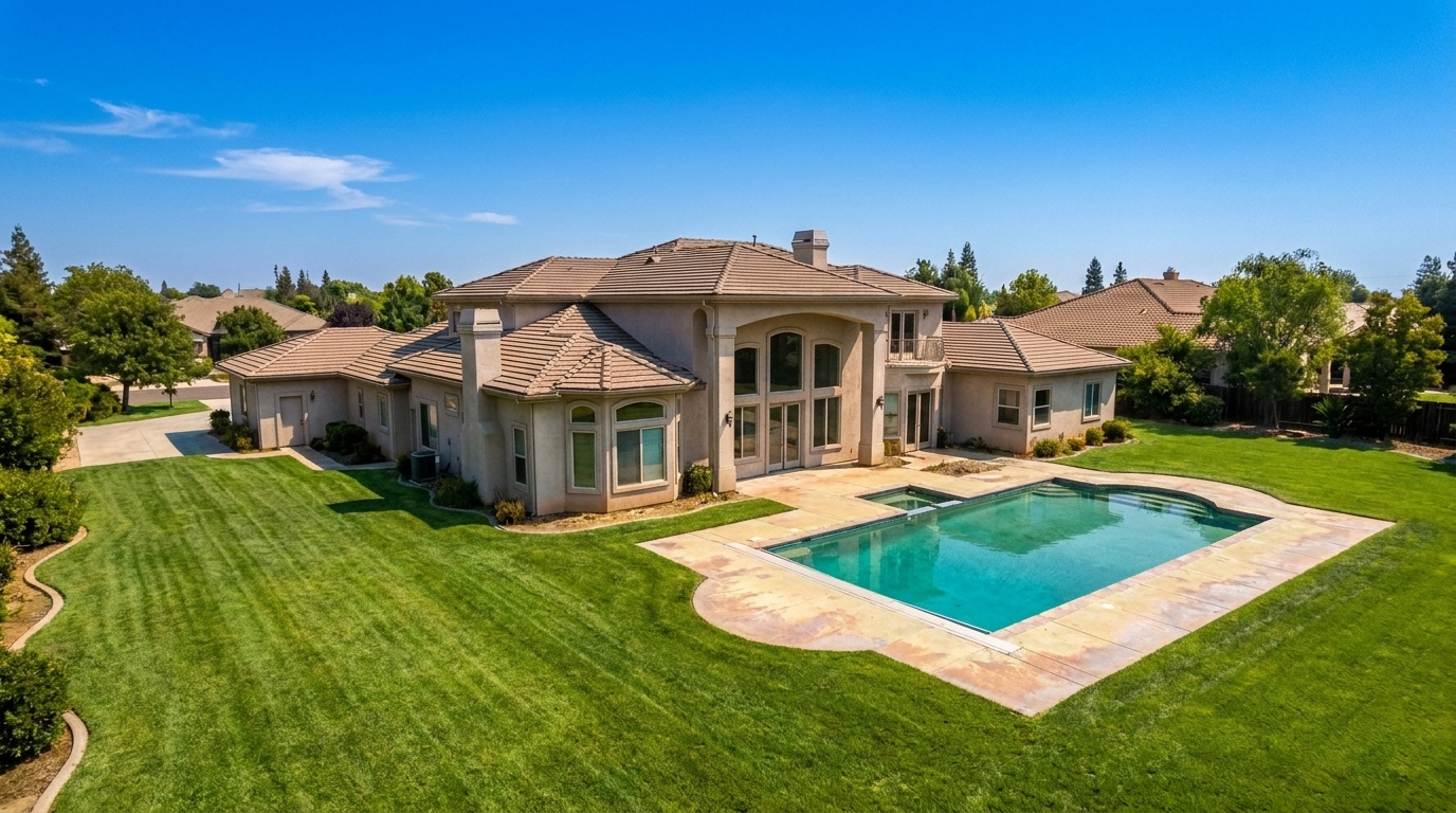
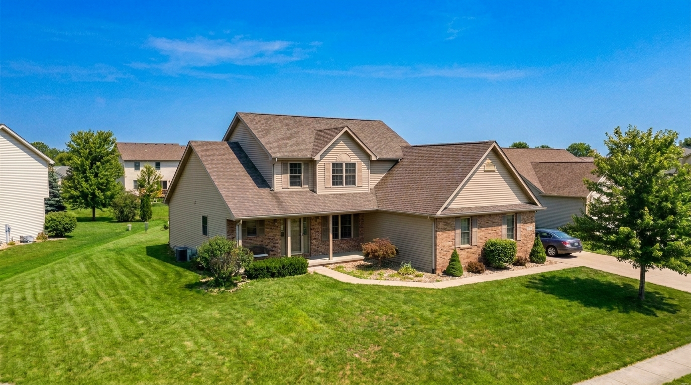 BeforeAfter
Before & After: Drone Photo Transformations
Compare raw aerial captures with our polished, market-ready listing results.
Suburban Lot Haze
Suburban Lot Haze updated with drone & aerial styling.
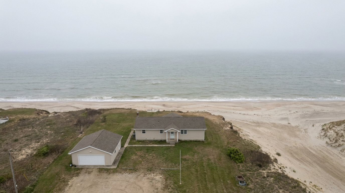
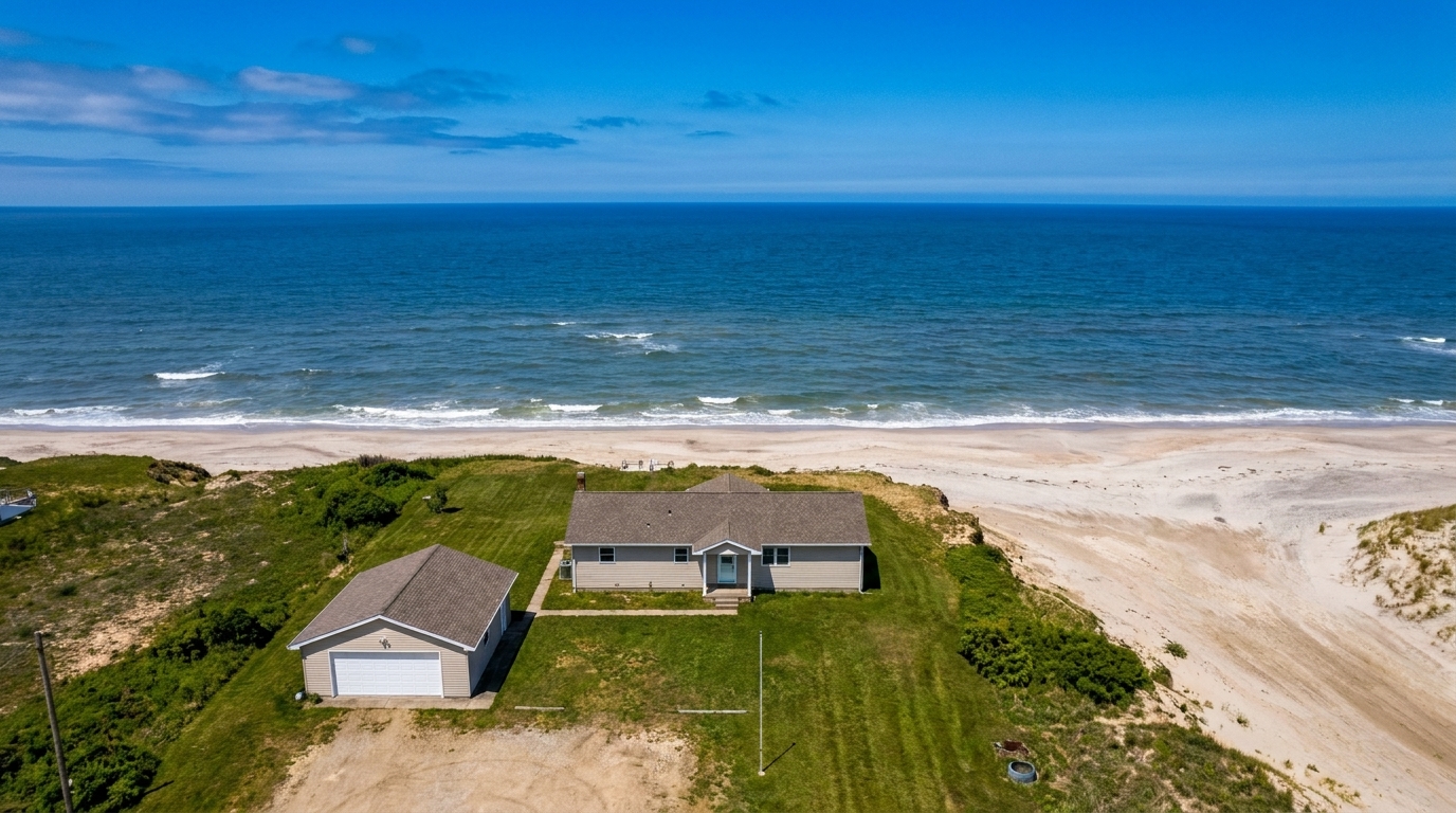
Dull Waterfront Estate
Dull Waterfront Estate updated with drone & aerial styling.
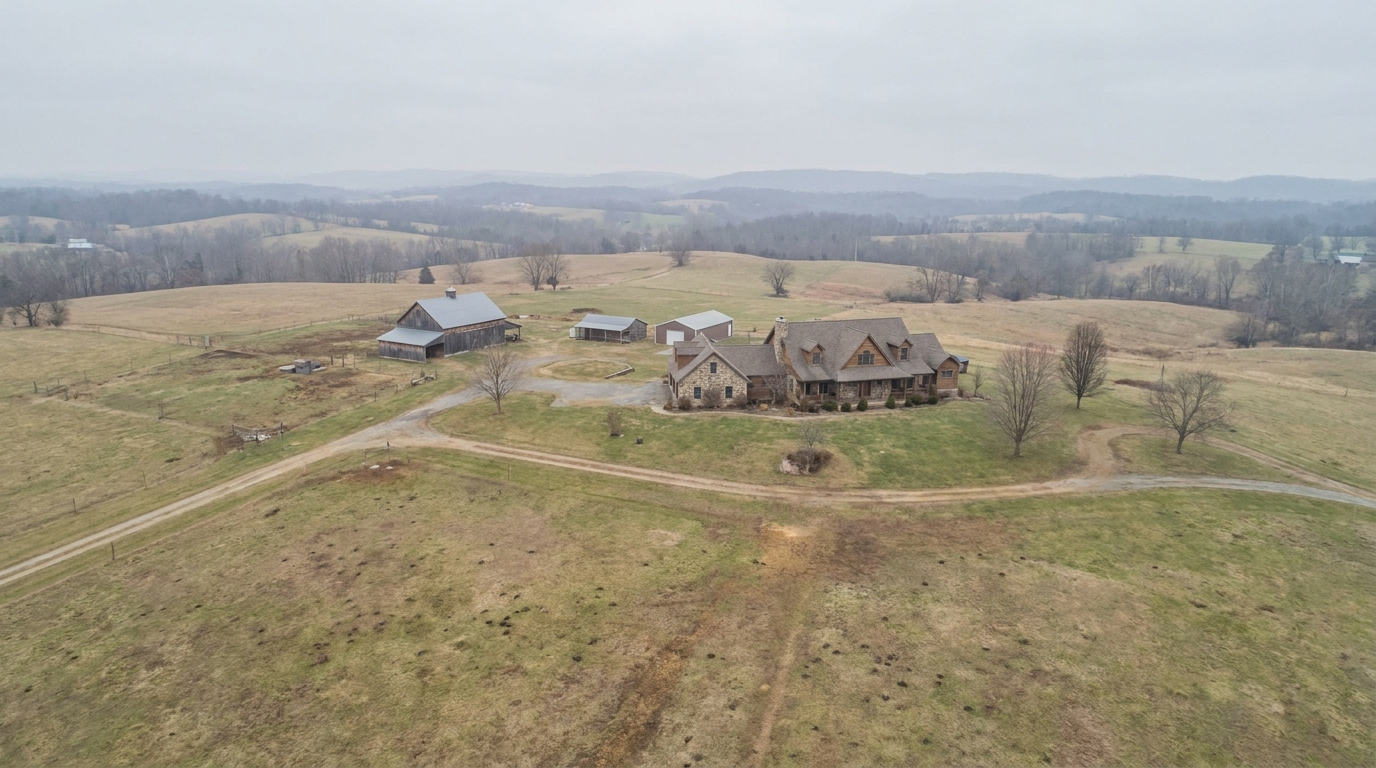
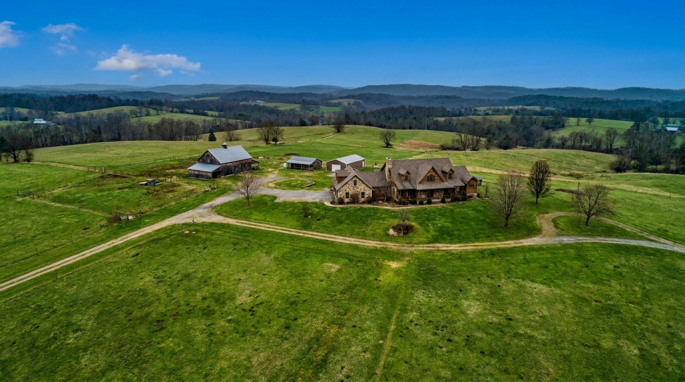
Overcast Acreage
Overcast Acreage updated with drone & aerial styling.
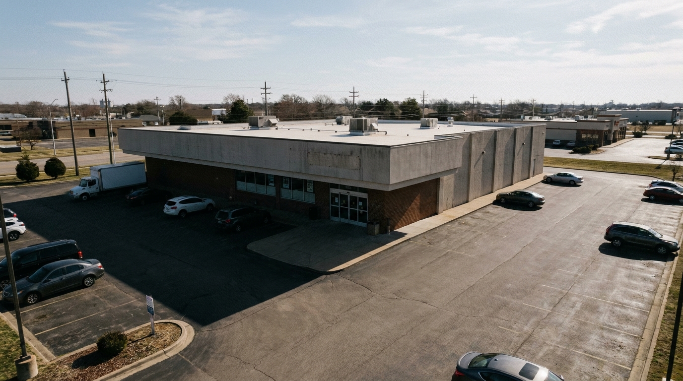
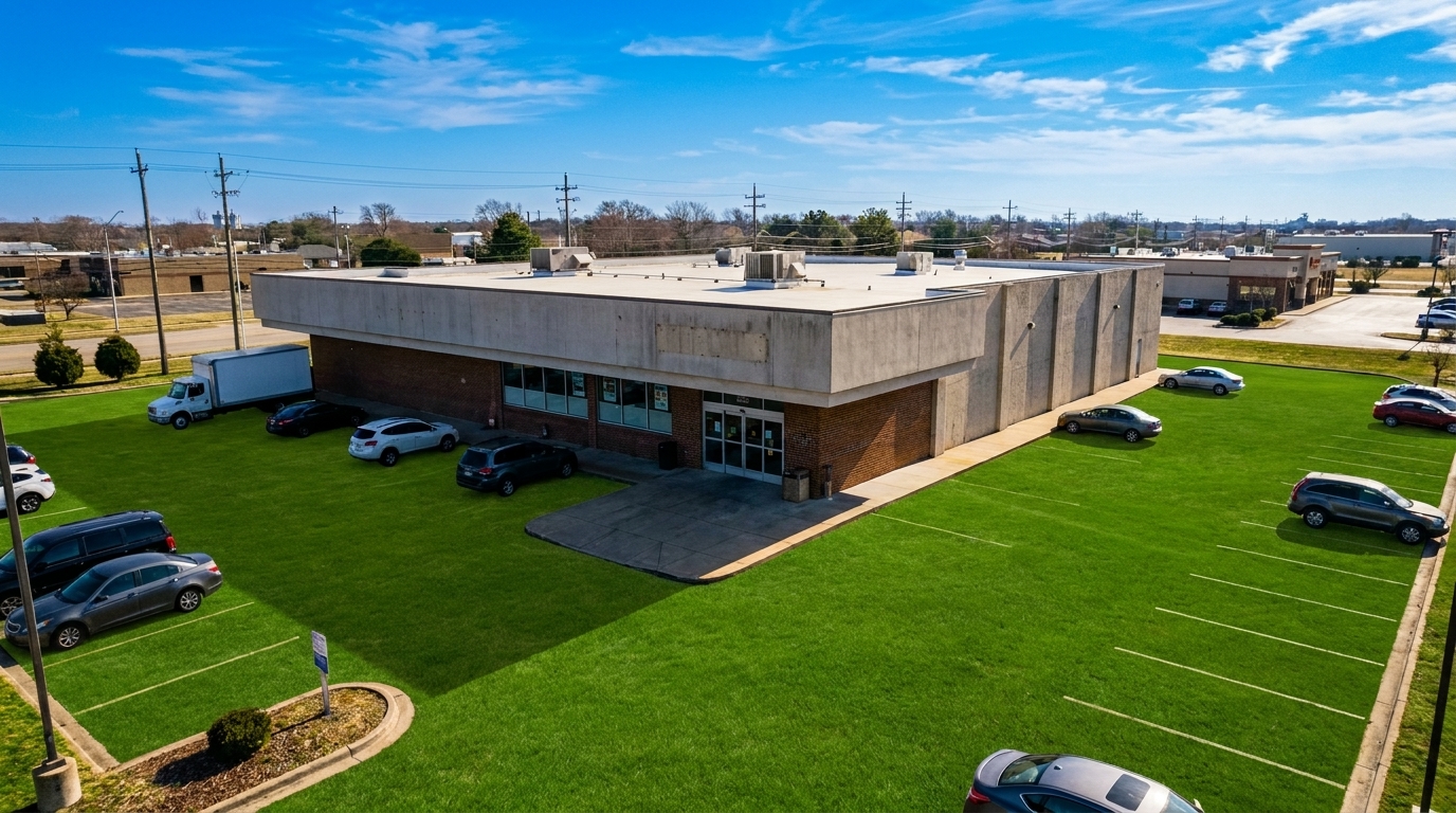
Shadow-Heavy Commercial Plaza
Shadow-Heavy Commercial Plaza updated with drone & aerial styling.
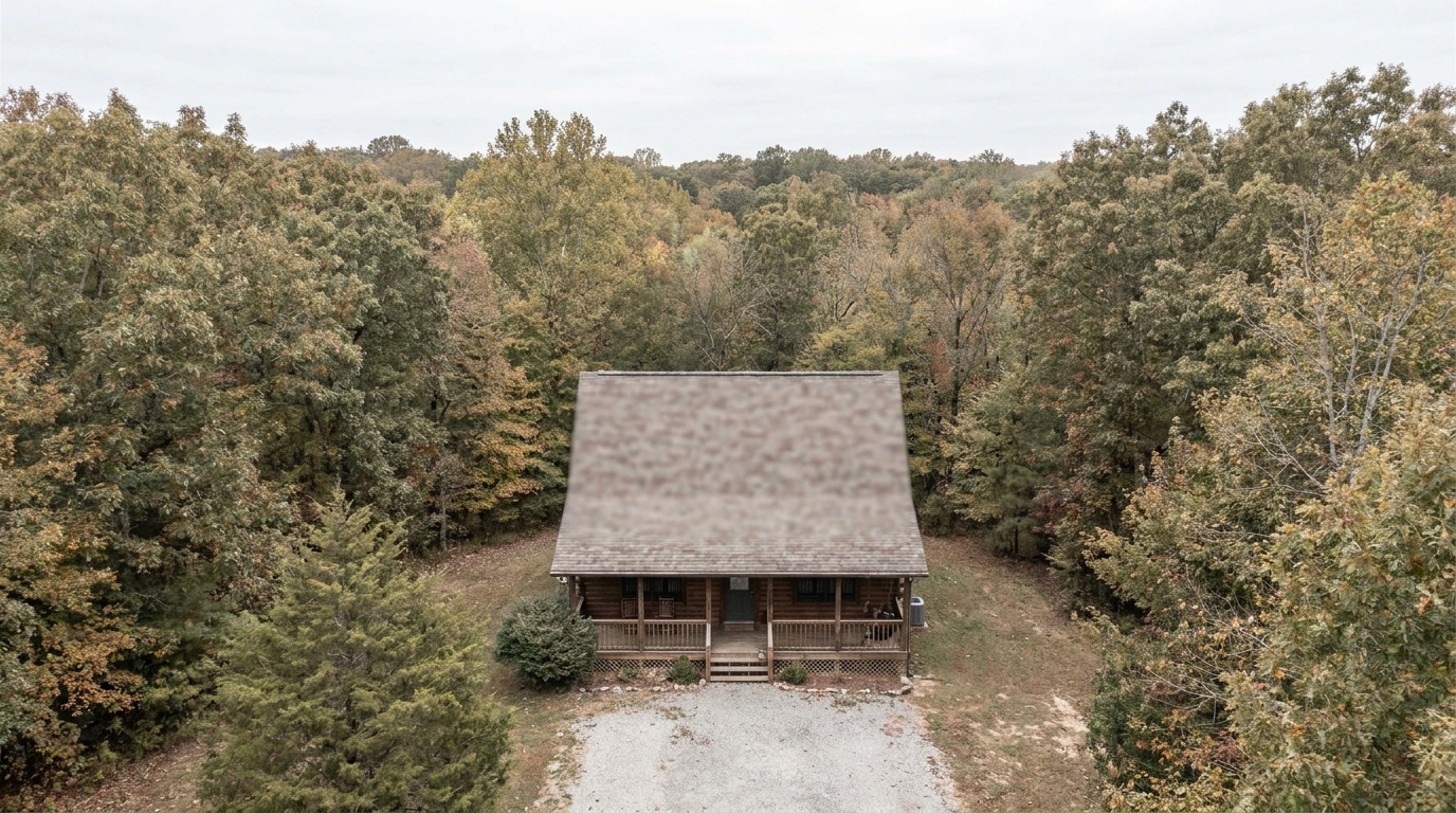
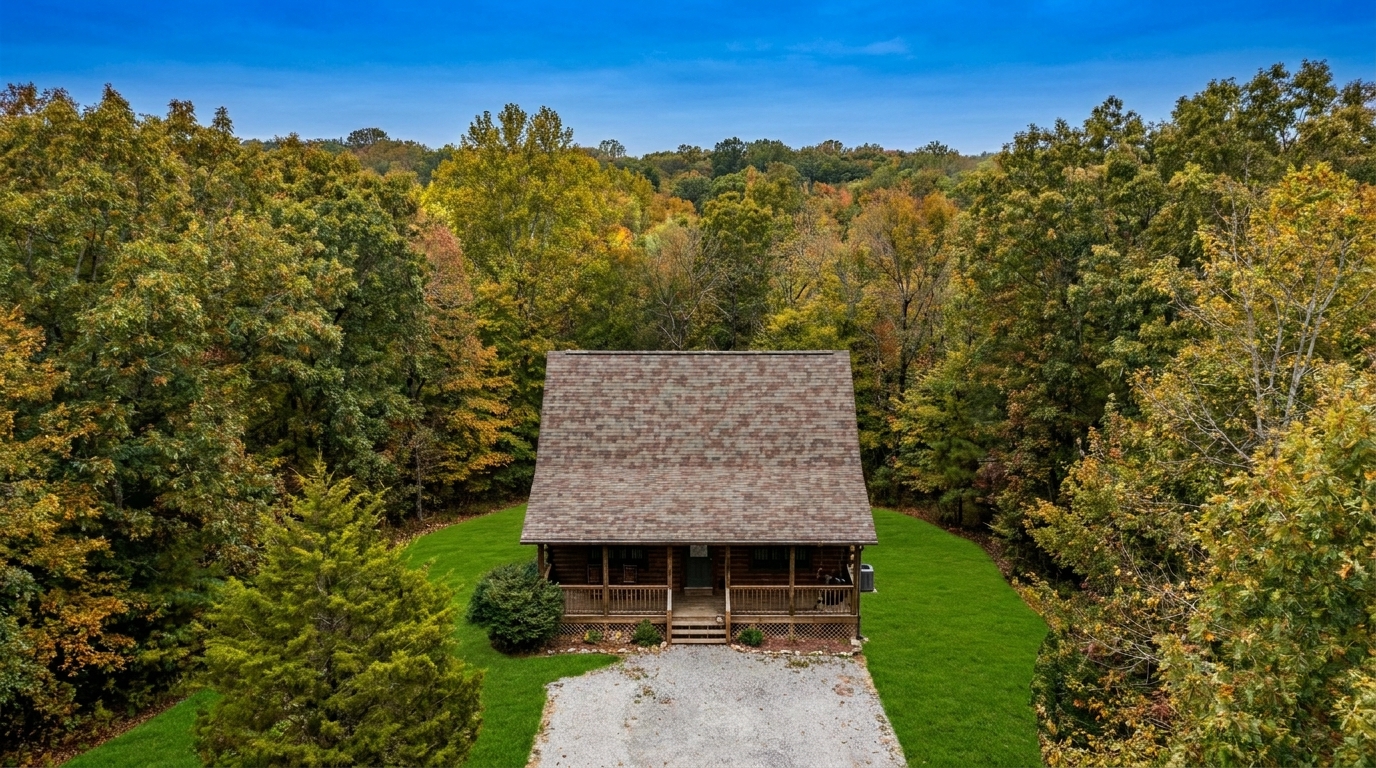
Faded Mountain Cabin
Faded Mountain Cabin updated with drone & aerial styling.
Dry Summer Lawn
Dry Summer Lawn updated with drone & aerial styling.
Powerful Features Built for Aerial Real Estate Photography
Advanced AI tools designed specifically to handle the unique lighting and scale of drone shots.
01
Atmospheric Haze Removal
Automatically cuts through high-altitude mist, fog, and smog to reveal crisp, clear property details from above.
02
Vibrant Landscape Balancing
Enhances the natural greens of lawns and the deep blues of pools or water features from a top-down perspective.
03
Smart Exposure Correction
Balances harsh midday sun and deep shadows common in wide-angle, unshaded aerial captures.
04
Property Boundary Sharpening
Enhances contrast along natural lot lines, driveways, and fences to make the property structure stand out.
05
Texture & Detail Recovery
Restores fine architectural details on roofs, decks, and hardscaping that often look flat from a distance.
06
Natural Color Fidelity
Keeps surrounding roads, neighboring homes, and natural features realistic while boosting the subject property's appeal.
Elevate Every Listing with Professional Aerial Enhancements
See how agents, photographers, and developers use drone photo editing to win clients.
Acreage & Large Estates
Showcase sprawling land boundaries, private roads, and outbuildings with clear, high-contrast definition.
Land & AcreageWaterfront Properties
Highlight proximity to lakes, oceans, or rivers with vibrant, deep blue water tones and clean shorelines.
Coastal & LakefrontSuburban Neighborhood Listings
Give buyers a clear sense of the home's position, lot size, and proximity to local amenities.
ResidentialCommercial Real Estate
Present retail centers, office parks, or industrial sites with clean, professional, high-altitude clarity.
CommercialNew Construction Developments
Help developers visualize master-planned communities and vacant lots with crisp, bright aerial layouts.
DevelopmentLuxury Home Portfolios
Elevate premium listings with dramatic, magazine-quality overhead shots that emphasize scale and prestige.
LuxuryHow to Enhance Aerial & Drone Photos in Seconds
Follow three simple steps to transform your high-altitude listing shots.
1
Upload Your Aerial Photo
Drag and drop your high-altitude drone shot or wide-angle aerial image directly into the Idealhouse editor.
2
Apply the Drone & Aerial Preset
Select the specialized preset to automatically cut through atmospheric haze, balance exposure, and enhance landscape colors.
3
Download Your Listing-Ready Image
Preview the enhanced property boundaries and vibrant surroundings, then export your polished, high-resolution photo.
Why Drone & Aerial Matters
Source-backed context for why drone & aerial edits matter inside exterior enhancement workflows.
Photos useful: 83%
Drone & Aerial within Exterior Enhancement evidence
Photos are one of the most valuable website features for home buyers; NAR's 2025 generational trends report says 83% of internet-using buyers rated photos as very useful. For Drone & Aerial pages, this supports showing how a focused Exterior Enhancement edit can make the listing photo feel clearer, more polished, and easier for buyers to evaluate.
Source: NAR 2025Photo priority: 26%
Drone & Aerial within Exterior Enhancement evidence
Zillow Research's 2025 prospective buyer report ranked high-resolution photos as the number two most important listing feature, selected by 26% of prospective buyers; floor plans ranked first at 33%. For Drone & Aerial pages, this supports showing how a focused Exterior Enhancement edit can make the listing photo feel clearer, more polished, and easier for buyers to evaluate.
Source: Zillow 2025Sale signal: 3 weeks
Drone & Aerial within Exterior Enhancement evidence
Redfin reported that professionally photographed homes in the $400,000 range sold three weeks faster and for more than $10,000 relative to list price compared with amateur photos. Use this as supporting context, not as a guaranteed result. For Drone & Aerial pages, this supports showing how a focused Exterior Enhancement edit can make the listing photo feel clearer, more polished, and easier for buyers to evaluate.
Source: RedfinMastering Aerial Real Estate Photography Enhancement
Aerial photography offers a powerful perspective, but high-altitude shots face unique environmental challenges. Learn how to optimize your drone photos for maximum marketing impact.
Overcoming High-Altitude Environmental Challenges
When shooting from 100 feet or higher, camera sensors must contend with atmospheric haze, moisture, and scattered light. This often results in flat, low-contrast images with washed-out colors. Our Drone & Aerial preset uses advanced algorithms to analyze depth and light scattering, effectively cutting through haze to restore natural contrast, sharpen distant structures, and bring out the true colors of the landscape below.
Choosing the Right Preset: Drone vs. Curb Appeal vs. Exterior Photo
Selecting the correct tool depends entirely on your camera's perspective and subject matter. Use the Drone & Aerial preset for high-angle, wide-context shots where the roof, yard, and surrounding landscape dominate the frame. If your photo is a street-level shot focusing on the front facade and entryway, choose the Curb Appeal preset. For general medium-range exterior shots that require a balanced mix of facade and sky correction, the standard Exterior Photo preset is your best option.
When to Use (and When to Avoid) Aerial Enhancements
Use this preset to make listings stand out on MLS, highlight large lot sizes, showcase waterfront proximity, and clean up flat lighting. However, avoid using it to artificially alter permanent features. Do not use enhancements to hide neighboring eyesores, misrepresent property boundaries, or apply unrealistic saturation that does not match the physical reality of the property, as this can lead to buyer distrust and compliance issues.
Workflow Integration for Real Estate Photographers
For high-volume photographers, speed and consistency are vital. Integrate this preset into your final editing pipeline after performing basic geometric corrections. By applying the Drone & Aerial preset as a final polish, you can instantly standardize the look of your aerial portfolio, ensuring that every overhead shot in your listing gallery matches the vibrant, high-quality aesthetic of your ground-level photos.
Explore More Exterior Enhancement Presets
Switch between specialized tools to polish every detail of your property's exterior.
Driveway
Clean up driveway appearance for a neater entrance and stronger first impression.
Open This Generator →
Curb Appeal
Elevate the home's exterior presence with a brighter, tidier, more inviting street view.
Open This Generator →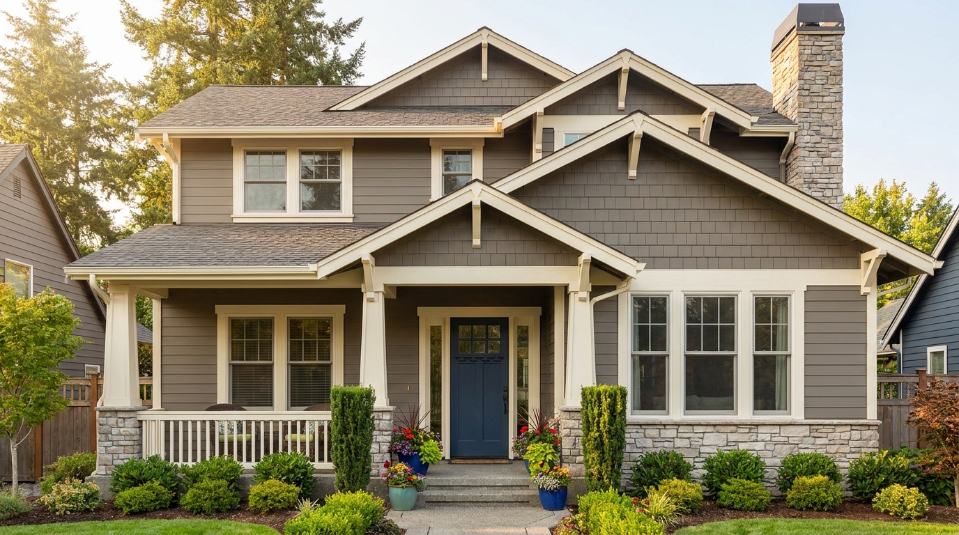
Exterior Color
Refine facade tones so exterior materials look cleaner, richer, and more appealing.
Open This Generator →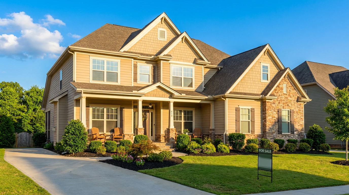
Exterior Photo
Full exterior enhancement for brighter skies, cleaner lines, and stronger curb appeal.
Open This Generator →
Lawn & Yard
Refresh grass and yard areas for a greener, healthier, better-kept outdoor look.
Open This Generator →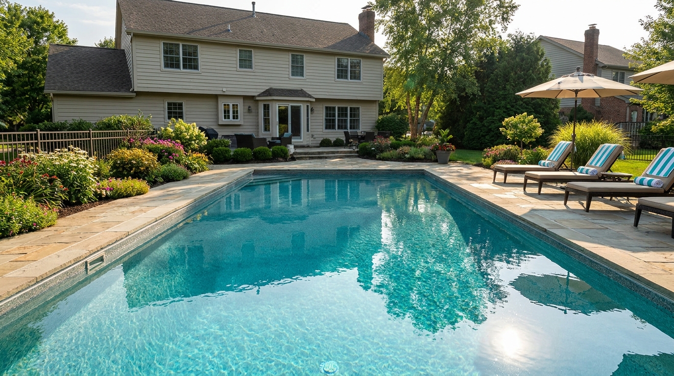
Pool
Make pools look clearer, brighter, and more inviting in listing photography.
Open This Generator →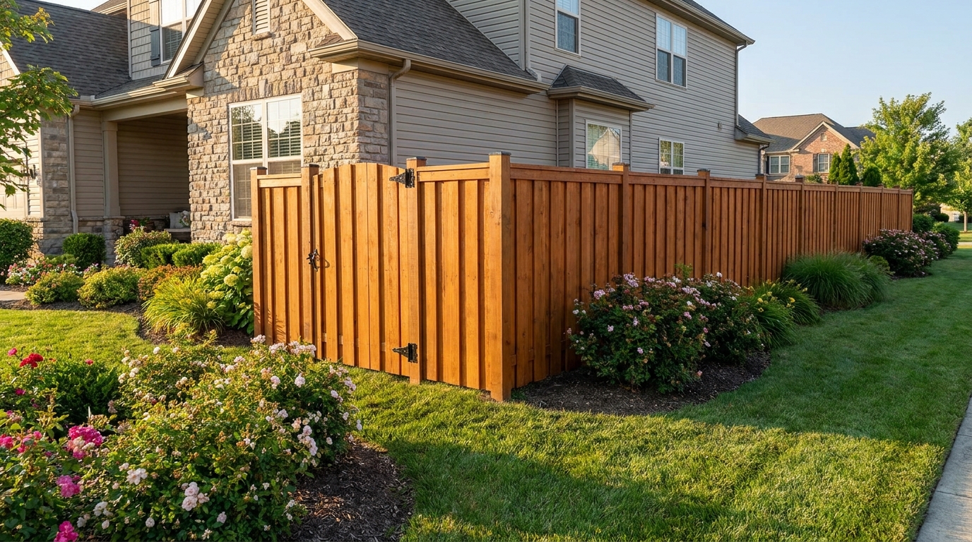
Fence & Gate
Improve fences and gates so they look cleaner, straighter, and better maintained.
Open This Generator →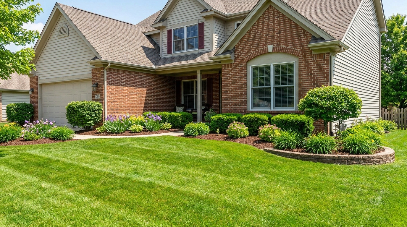
Landscaping
Enhance plants and greenery for a fresher, more vibrant, professionally styled exterior.
Open This Generator →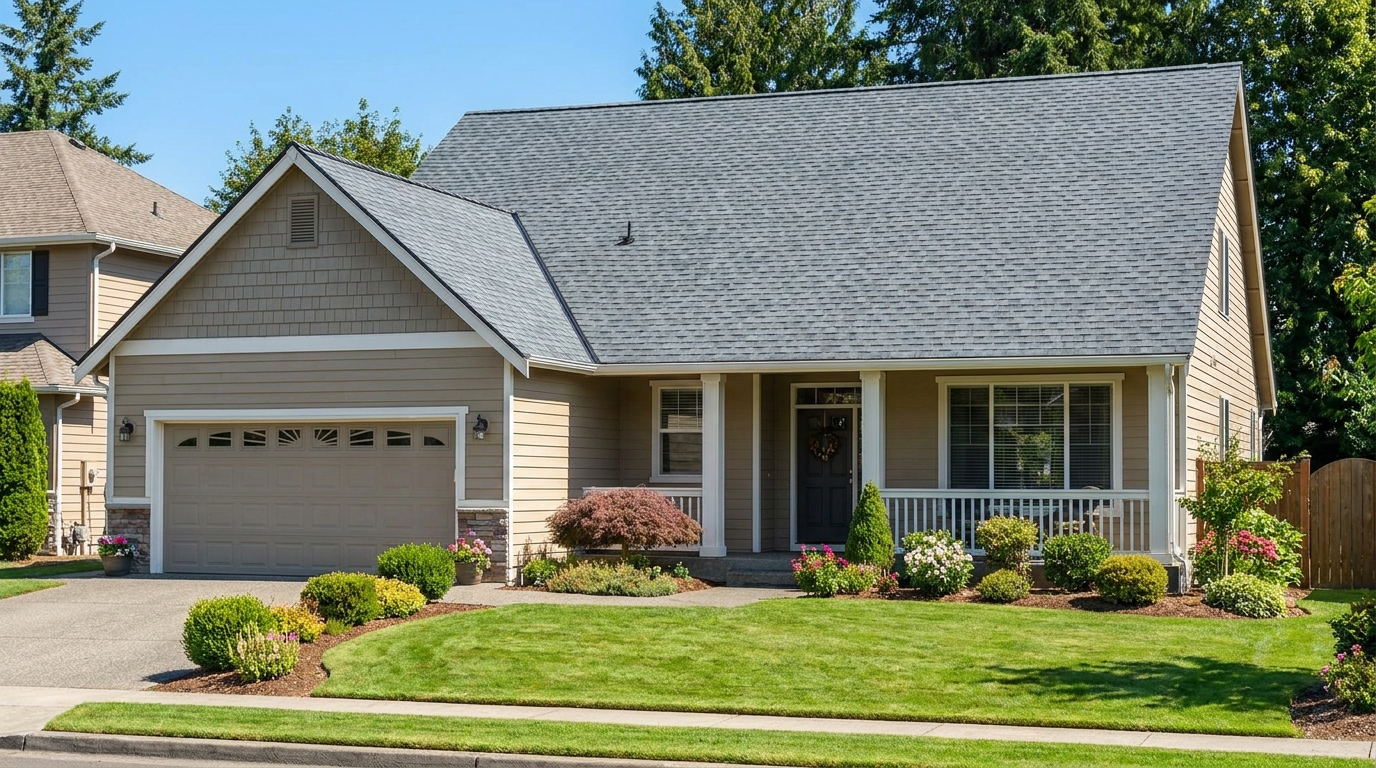
Roof
Clean and refine roof appearance for a more cared-for, market-ready exterior photo.
Open This Generator →Frequently Asked Questions About Aerial Photo Enhancement
While standard exterior tools focus on close-up facade details and curb appeal, the Drone & Aerial preset is calibrated for high-altitude challenges. It specifically targets atmospheric haze, wide-angle lighting imbalances, and large-scale landscape color correction.
Yes. It works exceptionally well for any elevated shot where landscape context, roofs, and wide-angle lighting are prominent, even if the photo wasn't taken by a drone.
No, this tool does not draw digital graphic overlays. Instead, it enhances the natural contrast, sharpness, and clarity of physical boundaries like fences, driveways, and tree lines to make them naturally easier to distinguish.
Absolutely. It is designed to cut through flat, gray lighting, boost natural contrast, and inject warmth and color into overcast aerial scenes without looking artificial.
We support all standard high-resolution image formats, including JPEG, PNG, and WebP, directly from your drone or camera.
No. Our AI is calibrated specifically to meet professional real estate marketing standards. It ensures colors, lighting, and details remain natural, realistic, and compliant with listing guidelines.
Discover More AI Photo Enhancement Tools
Explore our full suite of intelligent editing tools to elevate your real estate marketing.
Image to Video
AI image-to-video generation for turning home, room, and property photos into more vivid presentation videos.
Exterior Renovator
AI exterior renovation for visualizing facade updates, curb appeal improvements, and home exterior remodel ideas.
Landscaping
AI landscaping design for exploring outdoor concepts, curb appeal upgrades, planting ideas, and yard layout directions.
Virtual Staging
AI virtual staging for furnishing empty rooms and creating listing-ready interiors for real estate marketing.
AI Image Generator
Free AI image generation for turning text prompts into unlimited visual ideas for home design, interiors, landscaping, renovation
Object Remover
AI object removal for cleaning up distracting items from room, home, and property photos.
Elevate Your Aerial Listings Today
Don't let flat lighting or atmospheric haze dull your property's potential. Transform your drone shots into high-impact marketing assets instantly.
Ideal.House is more than a platform—it's your all-in-one home design ecosystem. Dive into powerful AI tools such as Interior Remodel, Exterior Renovator, and Landscaping to craft stunning spaces, and let HouseGPT guide you with tailored suggestions for planning, styling, and furnishing. Connect with a passionate community to swap ideas and advice, then take your designs from concept to completion with handpicked products matched to your taste.
At Ideal.House, we've built a space where technology, creativity, and collaboration come together to redefine home design.
At Ideal.House, we've built a space where technology, creativity, and collaboration come together to redefine home design.
Technical support [email protected]


'%3e%3cpath%20d='M162.5%20200H37.5C16.6667%20200%200%20183.333%200%20162.5V37.5C0%2016.6667%2016.6667%200%2037.5%200H162.5C183.333%200%20200%2016.6667%20200%2037.5V162.5C200%20183.333%20183.333%20200%20162.5%20200ZM37.5%208.33333C21.6667%208.33333%208.33333%2021.6667%208.33333%2037.5V162.5C8.33333%20178.333%2021.6667%20191.667%2037.5%20191.667H162.5C178.333%20191.667%20191.667%20178.333%20191.667%20162.5V37.5C191.667%2021.6667%20178.333%208.33333%20162.5%208.33333H37.5Z'%20fill='black'/%3e%3cpath%20d='M54.4224%2040C52.5284%2040%2050.653%2040.3737%2048.9032%2041.0997C47.1534%2041.8257%2045.5635%2042.8899%2044.2242%2044.2314C42.885%2045.573%2041.8226%2047.1656%2041.0978%2048.9184C40.373%2050.6712%2040%2052.5498%2040%2054.447C40%2056.3442%2040.373%2058.2229%2041.0978%2059.9756C41.8226%2061.7284%2042.885%2063.3211%2044.2242%2064.6626C45.5635%2066.0041%2047.1534%2067.0683%2048.9032%2067.7943C50.653%2068.5203%2052.5284%2068.894%2054.4224%2068.894C56.3164%2068.894%2058.1918%2068.5203%2059.9416%2067.7943C61.6914%2067.0683%2063.2813%2066.0041%2064.6206%2064.6626C65.9598%2063.3211%2067.0222%2061.7284%2067.747%2059.9756C68.4718%2058.2229%2068.8448%2056.3442%2068.8448%2054.447C68.8448%2052.5498%2068.4718%2050.6712%2067.747%2048.9184C67.0222%2047.1656%2065.9598%2045.573%2064.6206%2044.2314C63.2813%2042.8899%2061.6914%2041.8257%2059.9416%2041.0997C58.1918%2040.3737%2056.3164%2040%2054.4224%2040ZM82.4631%2079.8415V159.993H107.307V120.357C107.307%20109.898%20109.271%2099.7689%20122.217%2099.7689C134.985%2099.7689%20135.143%20111.727%20135.143%20121.017V160H160V116.045C160%2094.4536%20155.36%2077.8607%20130.166%2077.8607C118.071%2077.8607%20109.963%2084.5097%20106.648%2090.8022H106.311V79.8415H82.4631ZM41.9775%2079.8415H66.8608V159.993H41.9775V79.8415Z'%20fill='black'/%3e%3c/g%3e%3cdefs%3e%3cclipPath%20id='clip0_1255_15'%3e%3crect%20width='200'%20height='200'%20fill='white'/%3e%3c/clipPath%3e%3c/defs%3e%3c/svg%3e)

💰 Earn 10% commission as a Ideal House Affiliate Partner.
Join us